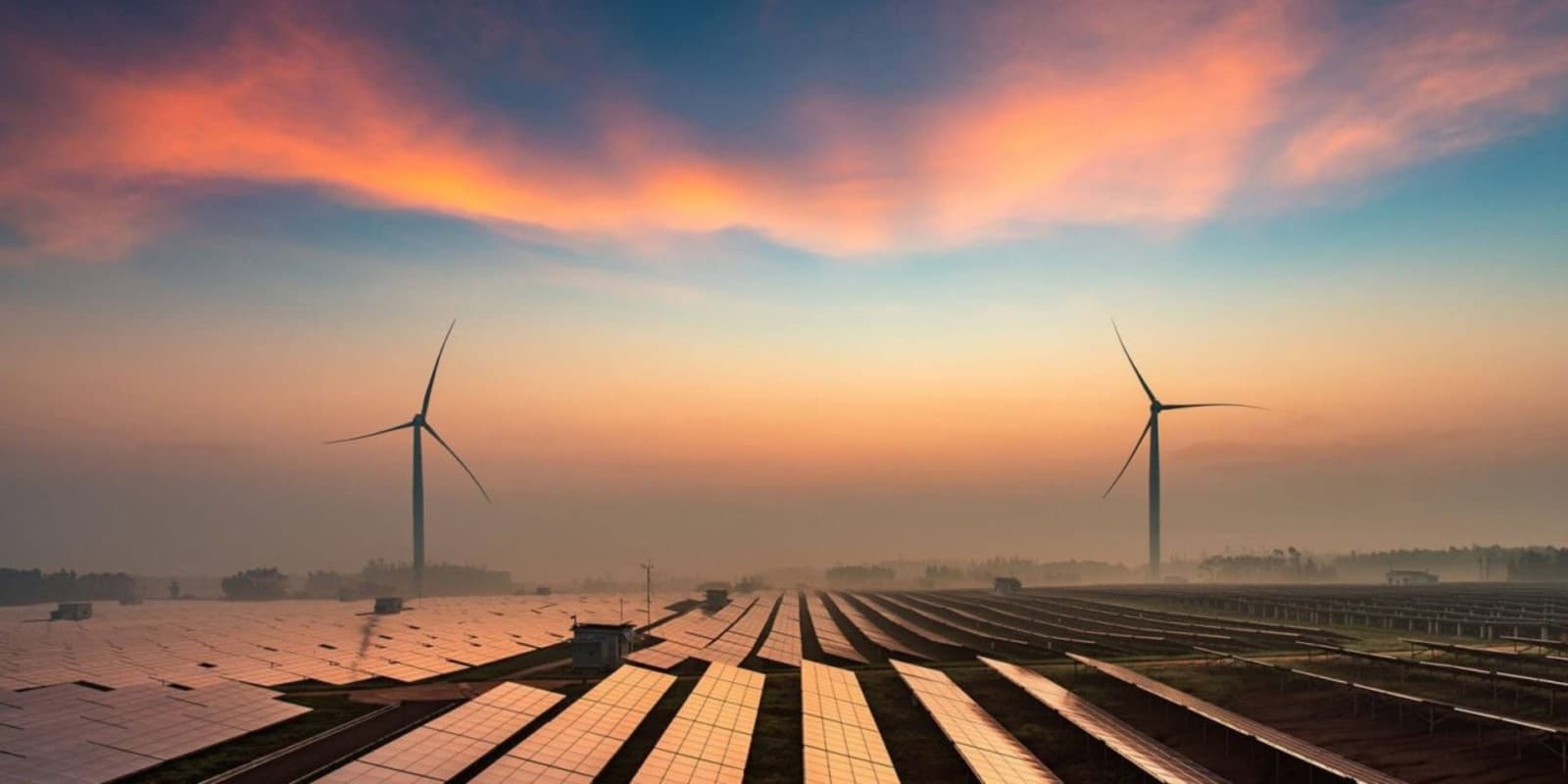
More Than 90% of New Renewables Are Cheaper Today

More Than 90% of New Renewables Are Cheaper Today

A young child playing on a rocky terrain near solar panels in Greece under a clear sky. by H O M A D via Pexels

.

IRENA: More than 90% of new renewables are already cheaper than any fossil fuel power plant

.

By Energía Estratégica • July 3, 2026

.

The agency warned that solar and wind energy are not only consolidating their cost advantage, but have also become a key factor in reducing exposure to gas volatility and strengthening energy security.

.

IRENA: More Than 90% of New Renewables Are Cheaper Today

IRENA

.

Renewable energies consolidated their leadership as the most competitive option for adding new electricity generation capacity by 2025. But, in addition to the economic factor, they are beginning to play an increasingly strategic role in a scenario marked by geopolitical conflicts, volatility in fuel markets, and greater demands for energy security.

This is according to the report “Renewable Energy Generation Costs in 2025” , published by the International Renewable Energy Agency (IRENA), which concludes that more than 90% of the large-scale renewable capacity added during the year was cheaper than the lowest-cost fossil alternative .

The organization argues that the competitive advantage of clean technologies is no longer limited to the cost of generation: it also represents protection against international uncertainty and fluctuations in oil and gas prices.

Wind and solar power extend their lead

The report’s data shows that solar photovoltaic energy maintained an average cost of US$44/MWh , while onshore wind reduced its costs by 4% , to US$33/MWh , consolidating itself as one of the most competitive technologies on the market.

In the case of offshore wind , costs also continued to fall and reached US$78/MWh , 3% less than the previous year.

The contrast with fossil technologies was even more marked.

IRENA points out that the global shortage of turbines has practically doubled the capital cost to build new combined cycle power plants in the United States, while in markets with high gas prices, such as Germany, Italy and Japan , generation costs exceeded US$100/MWh .

Added to this is the uncertainty stemming from the crisis in the Middle East, which continues to put pressure on international gas markets.

A shield against energy crises

Beyond the cost of producing electricity, the report focuses on another growing benefit of renewables: reducing dependence on imported fuels.

According to IRENA, the currently installed renewable capacity made it possible to avoid purchases of fossil fuels of around US$480 billion during 2025 , reducing the exposure of numerous countries to the volatility of international markets.

“Every additional megawatt of renewable energy strengthens economic protection against fuel price fluctuations and protects consumers, businesses and public finances,” said Francesco La Camera, Director-General of IRENA.

The organization believes that the expansion of renewable energy generation has become a strategic investment both to improve economic resilience and to strengthen the competitiveness of countries.

The impact of the crisis in the Middle East

The report also analyzes the effects of the closure of the Strait of Hormuz that occurred in early 2026, which triggered a sharp increase in international prices for gas and other energy commodities.

In that context, existing renewable energy generation helped to mitigate the economic impact of the crisis.

In Indonesia, Thailand, and the Philippines alone, renewable energy installations avoided approximately US$5.7 billion in coal and gas purchases during 2025.

If those same volumes had been acquired during the peak prices recorded between March and May 2026, the cost would have amounted to approximately US$6.5 billion .

China leads the world in savings

IRENA’s analysis of the top twenty economies shows that renewable energy avoided US$377 billion in fossil fuel purchases during 2025.

China topped the ranking by a wide margin with US$177 billion , equivalent to almost half of the total savings.

Behind them were the United States , with US$35 billion , Brazil , with US$32 billion , Germany and India , with US$18 billion each, and Japan , with US$15 billion .

Costs will continue to fall, albeit more slowly.

Since 2010, solar photovoltaic energy has reduced its costs by 89% , while onshore wind power has fallen by 71% , concentrated solar power by 72% , and offshore wind power by 63% .

However, IRENA warns that the pace of that reduction could slow down.

The reorganization of the manufacturing industry in China, the increase in the prices of raw materials and components, the fall in investments in new factories and a trade context marked by greater tariff tensions are beginning to put pressure on installation costs.

Even so, the agency’s projections indicate that renewable technologies will continue to reduce their costs until 2035 , although at a slower rate than that recorded during the last decade.

.

.


.

Two Centuries on, Experts Unlock Secrets of Red Sea . . .

Two Centuries on, Experts Unlock Secrets of Red Sea . . .

Stunning drone shot of Hurghada’s coastline and desert panorama during sunset. by Mo Ismail via Pexels

.

Two centuries on, experts unlock secrets of Red Sea and Gulf of Aden sailing chart

Published by Phys.org – 3July 2026

.

.

Two centuries on, experts unlock secrets of Red Sea and Gulf of Aden sailing chart

The document has been part of the Royal Geographical Society’s collection for 189 years. Credit: Royal Geographical Society


.

Experts have unlocked secrets hidden for two hundred years in a beautiful navigational chart made for 18th century seafarers negotiating the Red Sea and Gulf of Aden. The paper scroll is evidence seafaring communities in the region used their own effective system of navigation that enabled trade and exchange between India, Arabia and the Horn of Africa in the age of sail, before the uptake of a more abstract, instrument-based navigation.

The Indian Kachchhi/Gujarati document has been part of the Royal Geographical Society’s collection for 189 years and is one of the most detailed surviving indigenous navigational charts produced in the Indian Ocean tradition.

New research shows it was an effective aide memoire, capturing and reflecting the intimate knowledge of sailors from modern Gujarat in India. It is a window onto the indigenous navigational practices of people across the western Indian Ocean.

Researchers have been able to identify and interpret place-names and astronomical data inscribed on the chart for the first time, establishing latitude and providing sailing directions and showing intimate local knowledge: the chart was not simply designed to facilitate long-distance transit to first-order Red Sea ports.

The chart, which is adorned with beautiful images of ships and religious buildings, dates from the late 18th or early 19th centuries. It was acquired by Alexander Burnes in 1835 from an un-named sea captain in Kachch. He donated it to the Royal Geographical Society. However, he and subsequent scholars were not able to translate and analyze the map to the extent that the current study has.

Where earlier readings fell short

The 66 or so Devanagari place names on the chart have never been fully transcribed and identified and most European scholars who appraised the chart wrongly claimed that it had no latitude or longitude information. They also thought the fact it did not show the real angle of the Red Sea and Gulf of Aden was a shortcoming, when in fact, it makes the chart more portable.

Experts have produced a projection of the chart that presents the information it contains spatially in a way familiar to modern maps. The cartographer who made the document depicts more than 180 islands, plus reefs and other features such as landmarks, religious buildings and flags.

Alexander Burnes, who lived from 1805 to 1841, acquired the chart while lieutenant in the East India Company Service and assistant to the British Resident in Kachchh. Burnes had already won celebrity through his 1832 imperial expedition across Central Asia, which had resulted in a best-selling book, honors from London learned societies including the RGS, and an audience with King William IV.

He declared it would “form a specimen of naval surveying … unequaled in any of the cabinets of Europe” and believed it had been a working document used on board ship. But he didn’t realize it was a practical navigational chart.

The chart has been interpreted previously in 1947, 1987, 2002, 2012 and 2022, but scholars have overlooked the chart’s navigational affordances. Around half of the chart’s Devanagari toponyms were left unidentified and without locations—with more still lacking precision.

Two centuries on, experts unlock secrets of Red Sea and Gulf of Aden sailing chart

Credit: University of Exeter

How the scroll guided sailors

Researchers believe they have now found coordinates for all 66 toponyms and improved transcriptions of the Devanagari script.

They have found that the chart’s 29 rhumb lines serve three main purposes: establishing the principal trend of a coastline; indicating a direction of travel across open water; and, in possibly two cases, showing safe passage into and out of port.

Professor John Cooper, from the University of Exeter’s Institute of Arab and Islamic Studies, who led the research, said, “Today we are used to maps and charts that project space mathematically and to scale, making regions of the world visually familiar and accessible to us in a very particular way. Although this chart doesn’t look accurate to our way of thinking, it allowed seafarers with the necessary experience and knowledge of stellar navigation to negotiate some of the harshest and most challenging waters in the world. All the required information was packed into a very portable scroll just 25 cm wide.

“This is a rich and effective navigational reference work. Its stellar information allowed sailors to know their latitude and set sailing directions; its many place names and topographical information enabled them to locate themselves precisely; its religious buildings suggest the navigator’s Muslim faith; and its flags suggest nodes of political and fiscal action.

“It was designed for those with specific local navigational knowledge. Although rich, the inscribed information would not be enough to enable people uninitiated in regional seafaring traditions to navigate safely. But, for those who knew, it functioned as a handy reference at sea, fulfilling a mnemonic role. Its scroll format allowed it to be opened partially, showing only the relevant section, with the rest rolled away. It was stored and handled easily on board the ship.”

Dr. Katherine Parker, the Royal Geographical Society’s Cartographic Collections Manager, said, “Re-examining our Collections is an ongoing process that allows researchers to apply new methods, technologies and perspectives, uncovering the meanings and utility that these remarkable artifacts held for the people who created them centuries ago. We have been delighted to work alongside the team to bring a greater understanding of the navigational, geographical and cultural value of this chart, as well as the cartographic skill and knowledge of its creators, into focus.”

.

Provided by University of Exeter 

Who’s behind this story?

Stephanie Baum, Master’s in TESOL from The New School. Passionate about language learning and editing science news on biology and space exploration. Full profile →

Robert Egan, Bachelor’s in mathematical biology, Master’s in creative writing. Well-traveled with unique perspectives on science and language. Full profile →


.


.

The 2026 World Cup is the Greatest Architectural Experiment

The 2026 World Cup is the Greatest Architectural Experiment

Iconic FIFA soccer ball and Vancouver stadium, showcasing urban sports architecture. by The Six via Pexels

.

The 2026 World Cup is the greatest architectural experiment in the tournament’s history

.

Mark Gower, Kingston University

The 2026 World Cup is the greatest architectural experiment in the tournament's history

Dallas Stadium is one of 16 venues for the 2026 Fifa World Cup. Jeffrey McWhorter/EPA

When football commentators analyse a World Cup match, they tend to focus on tactics, technical ability, physical conditioning and psychology. If a team wins away from home, we hear about mentality. If a player scores a spectacular goal, we praise their vision or instinct. Yet there is another factor that receives remarkably little attention: the stadium itself.

The 2026 Fifa World Cup, hosted across the United States, Mexico and Canada, presents perhaps the greatest architectural experiment in the tournament’s history. Sixteen stadiums, spread across the three countries, are staging matches in environments that differ dramatically in size, scale, form, lighting conditions and spatial character.

Some are purpose-built football grounds. Others are enormous NFL arenas adapted for the world’s game. Several feature retractable roofs. Others remain open to the elements. Together, they create a fascinating question: can the architecture of a stadium influence player performance?

As an interior designer, I have spent several years researching the relationship between footballers, spatial awareness and stadium design. My research began with a simple observation: across football, teams consistently perform better at home than away.

Traditional explanations focus on crowd support, yet during the COVID pandemic, when matches were played behind closed doors, home advantage did not disappear. This suggests there may be more complex factors at work.

Playing the space

A player receiving a pass rarely begins processing information at the moment the ball arrives. Long before that pass is played, they have already built a mental picture of their surroundings. They understand where they are positioned in relation to the touchline, the penalty area, teammates and opponents. But they also orient themselves through a series of architectural cues embedded within the stadium itself.

These cues can be obvious or subtle. The angle of a stand. The location of a tunnel. The shape of a roof. The position of advertising. The colour surrounding the pitch. The direction of sunlight. The edge of a seating tier. Together, these become reference points that help players orient themselves and make decisions faster.

John Beck, Cambridge City manager in the early 1990s, would set up key markers in each of the four corners of the team’s home ground. The markers would be hoardings printed with the word “quality”. When full backs would receive a ball deep in their own half they would look up and were asked to hit the ball as hard as they could towards the quality signs. These were nicknamed “quality passes”. While quite a primitive tactic, it was effective for Beck; he guided the club to two successive promotions and to two successive quarter-final appearances in the FA Cup.

Mercedes-Benz Stadium in Atlanta, Georgia
Mercedes-Benz Stadium in Atlanta, Georgia is one of the 16 venues for the 2026 World Cup.
Kurtis Toliver/Shutterstock

At the 2026 World Cup, players have encountered some of the most distinctive football environments ever assembled for a single tournament. In Dallas, matches are taking place inside a stadium capable of holding more than 90,000 spectators. For many players, this will be the largest enclosed sporting environment they have ever experienced.

Suspended above the field are giant video screens so large they have become part of the stadium’s identity. Whether consciously or unconsciously, such dominant visual elements contribute to the player’s reading of space.

In Atlanta, a retractable roof and climate-controlled interior create conditions unlike those found in most traditional football grounds. The stadium’s vast pinwheel-esque roof structure and glass end wall produce a highly controlled environment where wind, temperature and external distractions are largely removed.

Mexico City’s Estadio Azteca provides a very different experience. It is one of football’s great cathedrals, steeped in memory and history. Generations of players have competed there, from Pelé in 1970 to Maradona in 1986. Unlike many newer venues, the Azteca was designed specifically for football, creating a spatial relationship between players and spectators that feels fundamentally different from many multipurpose grounds.

Meanwhile, venues such as Vancouver’s BC Place, with its retractable cable-supported roof, or Seattle’s Lumen Field, with its dramatic open end framing the city skyline, create visual identities that players must quickly learn to navigate and interpret.

Estadio Azteca in Mexico City
Estadio Azteca in Mexico City is one of football’s great cathedrals.
Macbeth_GP/Shutterstock

From a football perspective, the challenge is adaptation. The German footballer Thomas Müller once described himself as an “interpreter of space”, a phrase that captures something important about elite performance. Great footballers appear to slow down time. They often know what they are going to do before the ball reaches them. This ability is developed through experience and familiarity.

The more often players operate within a particular environment, the more effectively they build what psychologists call cognitive maps. Over time, the surroundings become familiar and require less conscious processing. This familiarity creates fractions of a second of additional thinking time. At the elite level, those fractions can make the difference between scoring and missing, winning and losing.

The challenge of a World Cup is that players rarely have this luxury. Teams move rapidly between venues. Conditions change from match to match. Architectural cues that were familiar in one stadium disappear in the next. Players must repeatedly rebuild their understanding of space and place. This is why preparation becomes so important.

For decades, coaches have analysed opposition tactics in meticulous detail. Yet comparatively little attention has been paid to preparing players for the architectural characteristics of the stadium itself. Understanding sightlines, lighting conditions, pitch orientation, roof structures and spatial landmarks could offer marginal gains that become decisive in elite competition.

From a design perspective, this raises an equally interesting question. Modern stadiums are increasingly designed around fan experience, hospitality and commercial revenue. Yet the primary performers within these spaces remain the players themselves. If architecture can influence orientation, perception and decision-making, should stadium design place greater emphasis on players? Perhaps this will be the next frontier in sporting performance.The Conversation

Mark Gower, Head of Department of 3D Design, Kingston University

This article is republished from The Conversation under a Creative Commons license. Read the original article.


The Conversation.


.

The West’s Climate Colonialism in the Greater Middle East

The West’s Climate Colonialism in the Greater Middle East

Desert, pyramids, Egypt, travel, sand, sky, Giza, dry, arid, barren, landscape, by Pexels via Pixabay

.

The West’s Climate Colonialism in the Greater Middle East

.

There is a disturbing structural parallel between the old global energy economy and the new green transition.

.

CARNEGIE MIDDLE EAST CENTER  Published on Jun 30, 2026

We are used to looking at the Middle East and North Africa (MENA) region through the geopolitical lens of wars, borders, and oil pipelines. But today, a resource struggle is playing out under our noses, wrapped in a very clean, eco-friendly package. What is being presented by Western countries as a global green transition is, in many cases, reproducing old patterns of economic dependence under a new environmental banner. In fact, when you strip away the polite diplomacy and the dry academic terminology, the climate-related action required of the developing world looks less like a shared global rescue mission and more like climate colonialism by the developed world.

To see the unfairness at the heart of this system, all you have to do is look at who caused the mess versus who is paying for it. Over the past two centuries, Western nations built their wealth, powered their cities, and secured their high standards of living by burning fossil fuels without a second thought. They effectively used up the world’s carbon budget in order to get rich. Now that the planet is facing an ecological crisis, the same countries want to impose universal emission targets on everyone equally.

It is a glaring double standard. Having reached a plateau of sorts, the industrialized West is essentially kicking out the developmental ladder behind it and telling those countries still building their infrastructure that they aren’t allowed to clamber up. This tension has historically strained relations between several Western countries and China, which is arguably the world’s foremost developing power. China aside, the MENA region, which has contributed a tiny fraction of historical global emissions but now bears the brunt of the physical consequences—from heatwaves to dried-up water sources—has not escaped the attention of the West. The latter continues to demand immediate, drastic emission cuts by the MENA countries.

Western states are also turning to Egypt and Morocco as prime locations for large-scale renewable energy and green hydrogen projects. With their abundant sunshine, wind resources, and proximity to Europe, these and other MENA nations are a favorable location for such enterprises, which are celebrated as beautiful examples of international cooperation in pursuit of renewable energy. However, if you look at where the power actually goes, the reality is chastening. A huge chunk of the clean electricity generated by these mega-projects isn’t being used to stabilize local power grids, prevent regional blackouts, or lower utility bills for the communities living in the vicinity of solar panels. Instead, it is being sent directly across the Mediterranean via massive undersea cables to power European factories, light up European homes, and charge European electric cars.

Even the international “carbon offset” market—whereby companies strive to compensate for their emissions by paying for green projects elsewhere that are intended to absorb an equivalent amount of carbon dioxide—has turned into a territorial grab. Major Western polluters such as commercial airlines, oil conglomerates, and Silicon Valley technology giants don’t want to cut their emissions because that would hurt their profits. To offset their burning of fossil fuels, these firms buy up huge tracts of land in developing countries such as Kenya, Tanzania, Uganda, and Zimbabwe, plant trees there, and then claim that they’ve “neutralized” their pollution. Companies that have done this include Delta Air Lines, Shell, Microsoft, Meta, and TotalEnergies. Critics argue that carbon offsetting reduces the incentive to cut emissions at the source while shifting the burden onto developing countries.

Then there is the financial trap. When MENA (and other) countries ask for the capital they need to adapt to severe climate shocks, such as rising sea levels threatening the fertile soil of Egypt’s Nile Delta, their Western counterparts rarely respond with direct compensation or reparations for the global damage their centuries-long industrialization has caused. Instead, the West offers “climate finance,” which is usually just a fancy term for high-interest sovereign loans. Vulnerable nations are forced to take on massive debts just to survive a crisis they didn’t create.

This creates a predatory cycle in which poor countries must divert their limited national budgets to pay back foreign banks in Washington, London, or Brussels, instead of investing that money into their own healthcare, education, or public services. During the 2022 United Nations Climate Change Conference in Sharm al-Sheikh, Egypt repeatedly urged wealthy nations to provide larger grants as well as compensation for climate-related losses suffered by hard-hit countries. Though initiatives such as Egypt’s Nexus of Water, Food and Energy program—an action plan for combating the effects of climate change—have attracted billions of dollars, much of the support still comes through loans and blended finance rather than direct compensation. This adds to concerns that the West is saddling climate-threatened economies with significant debt.

It’s as though colonialism didn’t disappear when foreign empires pulled their troops out of the MENA region. The new variant, climate colonialism, has dispensed with flags in favor of corporate sustainability targets, carbon credits, and promises of a world gone green. Yet the structural parallel between the old global energy economy and the new green transition is impossible to ignore. Historically, the West exploited MENA’s oil in order to fuel its rise to power. Today, it is exploiting the region’s sun, wind, and land to clean up the toxic side effects of that ascent. The West secures for itself green energy, clean air, and the right to lecture the rest of the world on sustainability, while countries from the Middle East to North Africa are left with droughts, mounting debt, and a new layer of economic dependency.

Climate change is a real and terrifying emergency that requires urgent action. But the global framework ostensibly meant to combat it is rooted in power, not fairness. In fact, the rules are rigged against the people paying the highest price. Only when wealthy nations begin treating climate finance as a matter of historical responsibility—providing grants instead of loans, supporting local ownership of renewable projects, and ensuring that developing countries are the first to benefit from their own natural resources—can the green transition become a genuinely equitable phenomenon. Until then, with environmental policies designed exclusively in Western capitals and corporate boardrooms, renewable energy will remain wedded to an extractive industry.

.

About the Author

Angie Omar

Angie Omar

Editor-in-chief, Sada

Angie Omar is an accomplished international journalist, editor, producer, and writer with a wealth of experience in the news and politics industries.

.

Diwan

Diwan, a blog from the Carnegie Endowment for International Peace’s Middle East Program and the Malcolm H. Kerr Carnegie Middle East Center, draws on Carnegie scholars to provide insight into and analysis of the region.

Learn More

.


.

Strengthen Regional Cooperation on Urban Resilience

Strengthen Regional Cooperation on Urban Resilience

Scenic view of the historic Kasbah in Algiers, capturing the old architecture at sunset with warm tones. by Adem via Pexels

.

Arab States strengthen regional cooperation on urban resilience and risk-informed development

.

UNDRR 30-06-2026

.

Photo of workshop participants with screen presentation
UNDRR ROAS


.

Representatives from governments, regional organizations, United Nations agencies, technical institutions and city authorities gathered in Algiers for a three-day regional workshop on urban resilience, smart cities and risk-informed development, reaffirming their commitment to building safer, more resilient and sustainable cities across the Arab States.

Organized alongside the inaugural meeting of the Arab Urban Resilience Committee, the workshop provided a regional platform to exchange knowledge, strengthen institutional coordination, and identify practical approaches for integrating disaster risk reduction into urban planning, governance and investment.

The event was organized by the League of Arab States (LAS), the Arab Centre for the Prevention of Earthquake and Other Natural Disasters (ACPEND), the United Nations Office for Disaster Risk Reduction (UNDRR), UN-Habitat, and regional partners, reflecting a shared commitment to advancing risk-informed urban development in support of the Sendai Framework for Disaster Risk Reduction 2015–2030 and the Sustainable Development Goals.

Advancing risk-informed urban resilience

The workshop focused on translating global commitments into practical action at the national and local levels, emphasizing the need to strengthen governance, improve risk-informed planning, and promote investments that enhance urban resilience.

Participants explored regional priorities for addressing urban risks, integrating disaster risk reduction into urban development policies, strengthening institutional coordination, and reinforcing collaboration between national and local authorities to better anticipate, manage and reduce current and emerging risks.

Discussions also highlighted the growing importance of resilient cities in addressing the interconnected challenges of climate change, rapid urbanization, infrastructure development and disaster risk, while ensuring that resilience is embedded within sustainable development planning.

From commitment to implementation through MCR2030

UNDRR facilitated a dedicated session on the Making Cities Resilient 2030 (MCR2030) initiative, showcasing progress across the Arab region and demonstrating how cities are translating global commitments into concrete local action.

The session highlighted practical tools and approaches for strengthening urban resilience, including the MCR2030 roadmap, the Disaster Resilience Scorecard for Cities, resilience action planning, disaster risk financing, disaster loss and damage data systems, and the Early Warnings for All initiative.

Participants also exchanged experiences from cities including Salalah and Alexandria, illustrating how local leadership, peer learning and partnerships are helping cities move from resilience planning to implementation. The discussion underscored the value of city-to-city cooperation and regional knowledge exchange in accelerating resilience action across the Arab region.

Building greener, smarter and more resilient cities

Participants explored how nature-based solutions, smart city approaches and digital innovation can strengthen resilience while supporting sustainable urban development.

Sessions examined the growing impacts of climate-related hazards, including extreme heat, flooding, drought and environmental degradation and highlighted the importance of resilient infrastructure, integrated urban planning, sustainable finance and community engagement in reducing disaster risk.

The workshop reaffirmed that resilient cities require coordinated action across all levels of government, supported by strong partnerships with academia, the private sector, civil society and local communities.

Strengthening regional cooperation

A key outcome of the meeting was the establishment of the leadership of the Arab Urban Resilience Committee, marking an important step towards strengthening regional cooperation on urban resilience.

Recognizing the leadership demonstrated by the City of Salalah through its engagement in the MCR2030 initiative and its contribution to advancing urban resilience across the region, the Sultanate of Oman was selected to chair the Arab Urban Resilience Committee, with Algeria and the State of Palestine serving as Vice-Chairs. The Committee will provide a regional platform to promote collaboration, facilitate knowledge exchange, and support the implementation of risk-informed urban resilience policies and practices across the Arab States.

The workshop concluded with renewed commitment from participating countries and partners to strengthen regional cooperation, enhance technical exchange, and accelerate the implementation of risk-informed urban development.

By connecting global frameworks with national policies and local action, participants reaffirmed that resilient cities are fundamental to protecting development gains, reducing disaster risk, and advancing sustainable development throughout the Arab States.

.

.


.